
Sri Lanka's Department of Meteorology warned yesterday that there is a 90 percent chance the El Niño event that is forming in the Pacific Ocean will become stronger, forming a singular volatile El Niño event.
The World Meteorological Organization (WMO) also predicted that there is a 90 percent chance of a very strong El Niño event between August 2026 and October 2026.
Sri Lanka's Department of Meteorology Director General Ajith Wijemanna stated that weather forecast reports are showing that this year's El Niño may be the strongest one in the last 75 years.
He told Sri Lankan media that global forecast models show that there is a 90 percent chance a very strong El Niño event will occur by the end of the year. He also said that compared to the El Niño events since 1950, this year's event may be stronger than the previous years by almost 70 percent.
Wijemanna went on to say that Sri Lanka's northern, north-central and north-west provinces, Monaragala District and Hambantota District are seeing high temperature increases. However, he said that as the western provinces and the Sabaragamuwa Province are experiencing rain, they do not detect much of a temperature spike in the areas.
As per Sri Lanka's Department of Immigration & Emigration, the reservoirs under their purview have seen a 37 percent reduction in water, with them urging the public to make use of the water economically. The department estimates that if the water is used economically, it will be enough until Sri Lanka's harvesting season and the period of rainfall in November and December.
Sri Lanka's National Water Supply and Drainage Board (NWSDB) have stated that even though there are high temperatures in many regions in Sri Lanka, water treatment plants are currently operating at 100 percent capacity, and even though some reservoirs have experienced a 56 percent loss of water, there are currently no limitations in providing the public with water.
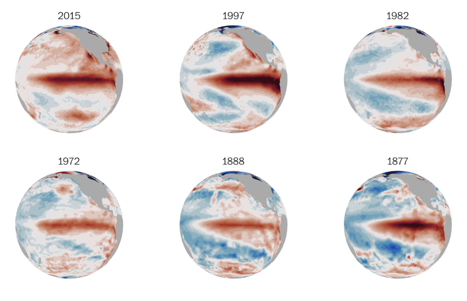
What is El Niño?
El Niño is a natural weather phenomenon caused by temperature spikes beyond the normal range along the surface of the ocean. Because of this:
- Surface temperatures along the eastern and central Pacific Ocean rise.
- Major changes to the global wind circulation, pressure and rainfall are experienced.
- This phenomenon will usually continue for 9 to 12 months.
The WMO's latest global seasonal climate update shows that El Niño is getting stronger and that the global weather system will be greatly affected by it.
- Strengthening El Niño: More than 90 percent chance this year's El Niño will become much stronger between August and October, as was forecasted by the WMO. It is estimated that important regions in the Pacific Ocean will experience temperatures 2.9 degrees Celsius higher than normal.
- Effects on the global temperature: As global ocean temperatures have climbed to record levels, El Niño may cause temperature spikes across various countries. This includes India, Arabian Peninsula, Africa, Europe and South America.
- Indian Ocean Dipole (IOD): WMO highlighted the formation of a positive IOD with El Niño. When these two weather phenomena collide, the danger of worsening weather along the Indian Ocean, along with rising temperatures, a lack of rainfall and flash floods will increase.
- Rainfall changes: Due to El Niño, the Indian continent, the northern regions of South America and some parts of Australia will experience less rainfall. However, eastern regions in Africa, Central Asia and some regions in Africa may see an increase in rainfall compared to the usual amount.
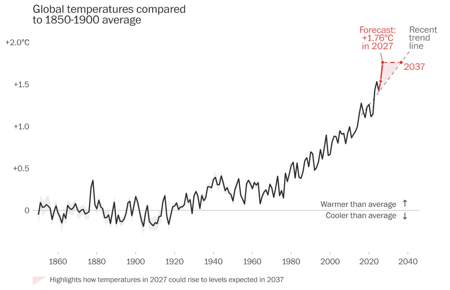
Secretary-General of the WMO Celeste Saulo stated that in a time ocean temperatures have risen, the formation of such a strong El Niño along with the weather warnings that signal potential damage gives governments from various countries and their citizens the opportunity to make preparations in advance.


